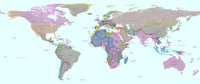
A hundred years ago, the world was a different place. The European nations had carved up much of Africa and Asia into rival empires. When war broke out in Europe in August 1914, the conflict quickly spread to many of these far-flung colonial possessions, with battles fought in the South Atlantic, East and West Africa, the Middle East and the Pacific. Using period sources, Planetary Visions has compiled a digital map showing the nations and territories of the world one hundred years ago, on the eve of the First World War.
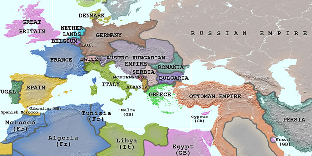
In Europe, countries including Ireland, Poland and Ukraine did not exist as independent states. Eastern Europe was dominated by the Austro-Hungarian and Russian Empires. The Ottoman Empire controlled most of the Arabian Peninsula. In Africa, only Abyssinia remained free of European control.
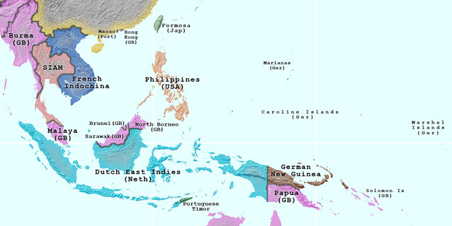
In the western Pacific, Germany had acquired the Marianas, Caroline and Marshal Islands, and part of New Guinea. Today's Vietnam, Laos and Cambodia were territories of French Indochina, and Indonesia was known as the Dutch East Indies. Colonial possessions dotted the Chinese coast - the Portuguese controlling Macau, the British Hong Kong and Weihaiwei, the Japanese Port Arthur, and the Germans Tsingtao. German overseas possessions were transferred to the protection of other countries as part of the settlement at the end of the Great War, and are now, like the former colonies of the other European powers, mostly independent states.
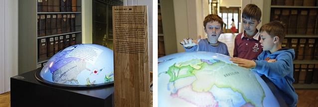
Our 1914 World Map was created for an interactive digital globe installation at the Strohmuseum, Wohlen, Switzerland. Planetary Visions researched modern and period map sources and geometrically corrected them to a common map projection before reconciling the borders of more than 200 territories and overlaying them on a hill-shaded background. The interactive globe hardware and software was provided by MediaScreen Bildkommunikation. (Photos: Felix Wey)