



| Width | 24,825 pixels | |
| Height | 20,774 pixels | |
| 300 dpi print width | 82.8 inches | 210.2 centimetres |
| 300 dpi print height | 69.2 inches | 175.9 centimetres |
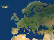
This mosaic of cloud-free satellite images shows Europe and the Mediterranean Sea in natural colour from the Atlantic Ocean in the west to the Caspian Sea in the east and from the Sahara Desert in the south to the Arctic Ocean in the north.
Based on images from the MODIS instrument on NASA's Terra satellite, with a pixel size of 250 metres, the mosaic was jointly developed by Planetary Visions in the UK and the German Aerospace Centre (DLR).