Analysis
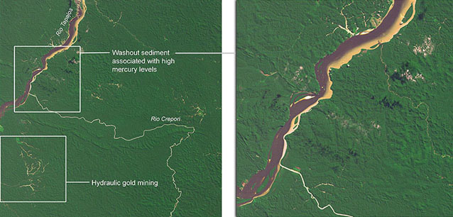
This Landsat image shows evidence of the hydraulic mining of gold in the Tapajos River Basin in Brazil. Bright areas in the forest show where the banks of streams have been washed out and panned for gold, reducing vegetation cover and exposing the soil. The disturbed sediment makes the river water appear bright brown, as seen where the River Crepori enters the larger River Tapajos on the left of the image. We used Landsat 5 data to illustrate this story, enhancing the natural colour image with an infrared channel to improve contrast in the river water and mined areas.
High levels of mercury are associated with the disturbed sediment, representing a threat to the food chain in the rivers. Although mercury is used in gold extraction, it seems there is a much larger amount of naturally-occurring mercury released with the disturbed sediment.
Data source: Landsat 5 TM data courtesy of UMD-GLCF