Earth clouds texture map (4302)
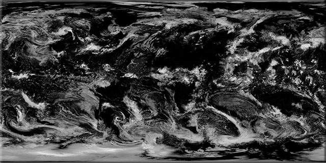
We spent almost a year taking the clouds out, but you can put them back if required! Our clouds texture map shows frontal systems, tropical thunderheads and storms with a pixel size up to 1km based on NASA's polar-orbiting Terra satellite.
Our clouds texture map is available as a separate texture map, but we have also
blended it with our 1km Satellite Imagemap.
| Resolution | Columns | Rows | File size | 300 dpi print width |
|---|
| 32.0 km | 1,350 | 675 | 3 MB | 4.5 in | 11.43 cm |
| 16.0 km | 2,700 | 1,350 | 10 MB | 9.0 in | 22.86 cm |
| 8.0 km | 5,400 | 2,700 | 42 MB | 18.0 in | 45.72 cm |
| 4.0 km | 10,800 | 5,400 | 167 MB | 36.0 in | 91.44 cm |
| 2.0 km | 21,600 | 10,800 | 667 MB | 72.0 in | 182.88 cm |
| 1.0 km | 43,200 | 21,600 | 890 MB | 144.0 in | 365.76 cm |
Samples
