Simulate Colour
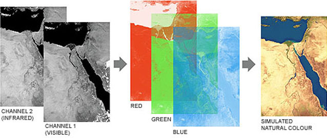
Satellite-borne sensors often use infrared as well as visible light. There is less atmospheric scattering at some infrared wavelengths, allowing infrared light to penetrate haze and smoke more easily. There is also greater distinction between different types of surface cover such as vegetation, rock and soil types and water. Infared satellite images are often delivered in "false colour" (above left), with vegetation appearing red, following the convention established with infrared aerial survey photography.
We have developed techniques to simulate natural colour from false colour images, to combine infrared channels with visible channels to improve clarity, and to synthesise natural rgb colour from sensors, such as those on weather satellites, which have only one visible channel (right).