Terrain Shading
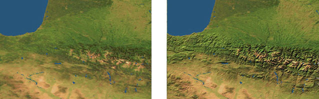
Although mountains and valleys are clearly seen in high resolution satellite images, they become indistinct in regional and global views. By using digital terrain data we can sharpen up these less detailed images (left) by adding hill-shading (right). Shading can be applied from the northwest in accordance with cartographic convention, or to match the sun direction at the time a satellite image was taken. Non-linear height mapping allows us to fine-tune the shading to enhance areas of low relief without saturating shadows or highlights in areas of high relief.